Watch the video: Openwind Overview
Design wind farms that are optimized for levelized cost of energy with Openwind by UL Solutions. This state-of-the-art software creates turbine layouts to maximize energy production, minimize energy losses, account for development costs and generate overall efficiencies, all on one platform. With Openwind, you can take into account wind resources, wakes, noise, shadow flicker, curtailments, GIS constraints and more. Openwind’s compatibility with other wind software allows you to easily import external wind resource grids and data files into an Openwind project. Developed with more than 30 years of advisory experience, and used by 70 percent of the top global wind developers, Openwind is the comprehensive software you need to design with confidence.
Wind farm design software developed on more than 30 years of expertise
Openwind is a wind farm design and optimization software used throughout a wind project’s development to create optimal turbine layouts that maximize energy production, minimize energy losses, account for plant development costs and generate overall project efficiencies.
Our software was developed by drawing on more than 30 years of advisory expertise, which has helped ensure that stakeholders involved in wind project development around the world have confidence in our platform. Additionally, Openwind’s compatibility with other computer wind programs enables you to seamlessly share files and easily migrate existing procedures into our software.
Maximize energy production
Cost of energy optimization
Optimize layouts and turbine positions to minimize the cost of energy, taking into account energy production, operations and maintenance costs and capital costs including turbine and plant development costs. Understand the impact each turbine has on the bottom line. Arrive at the best layout by taking into account:
- Access road costs
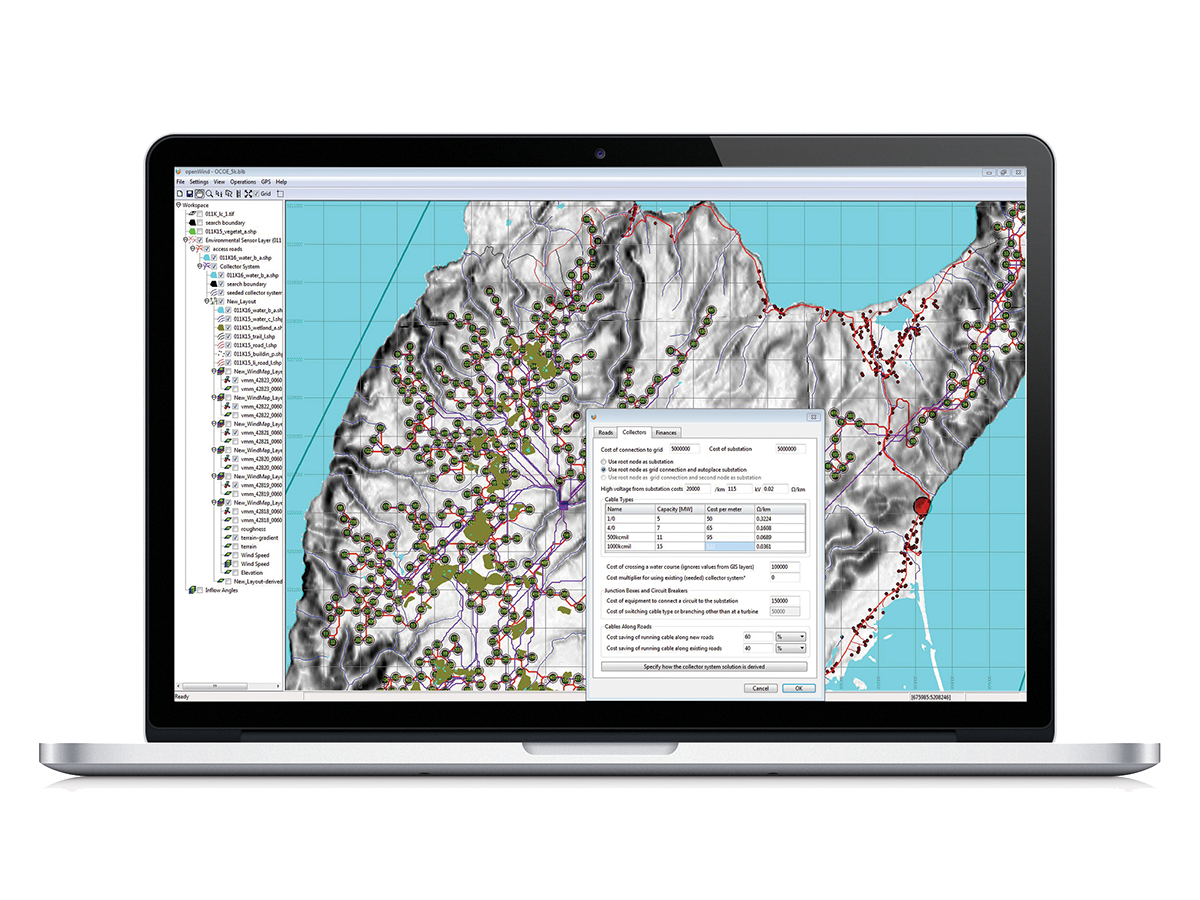
- Collector system costs
- Waterways, pipelines, fence lines, wetlands and more
- Substation and grid connection locations
- Electrical losses
- Power purchase agreement length
- Operations and management costs
- Wind resource and wake losses
Reduce and quantify uncertainty
- Model environmental and directional curtailments
- Accounts for measurement uncertainty, MCP uncertainty and modelling uncertainty
- Assign turbines to met masts, adjust Wind Resource Grids (WRGs) and run energy estimates
- Let the software suggest additional sites for met masts to extend the monitoring campaign and minimize project uncertainty
Multiple design turbine layout option
- Analyze multiple turbine layout options for cost effectiveness including different hub heights and turbine types
Gridded turbine layers
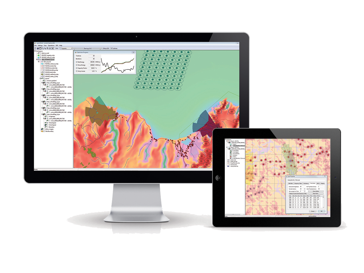
- Quickly create and modify gridded turbine layouts using the user-friendly GIS interface
- Design by hand using intuitive graphical tools
- Allow optimizer to determine downwind and crossing spacing, grid orientation and obliquity
Minimize energy loss
Deep Array Wake Models (DAWM) and Standard Wake Models
Leading-edge wake models consider the dynamic interactions between turbines and atmospheric boundary layer as well as allowing wakes to vary with turbulence intensity and stability. Openwind offers users five different customizable wake models to choose from including:
- Modified Park
- N. O. Jensen (variety of wake combination schemes)
- Eddy Viscosity
- Deep Array Wake Models (Park and Eddy Viscosity versions)
Time series energy capture
(12x24s, annual or long-term time series at hourly or 10 minute intervals)
- Run energy capture calculations that take into account time-varying temperature, air density, and turbulence intensity
- Model realistic availability using Markov chain models, which can vary with season
- Model high wind hysteresis, low- and high-temperature shutdown losses
- Diurnally varying wake losses
- Icing losses based on met data
- Parasitic consumption, blade heating and electrical losses
- Effects of bat curtailment and NRO modes
- Output results for entire project or individual turbines
Directional curtailment, inflow angle, turbulence
Model effects of directional curtailment by specifying curtailment strategy in detail or by setting criteria for automatic sector management.
Non-ideal performance losses
Use multi-height met mast data to assess the effects of non-standard shear using the rotor equivalent wind speed and adjust power curves for different ranges of turbulence intensity.
Environmental management
- Noise Modeling
- ISO 9613-2
- Harmonoise
- CNOSSOS-EU (NMPB 2008)
- Vary atmospheric attenuation based on ISO 9613-1
- Automatically generate NRO strategies based on noise constraints
- Turbine Scheduling (Noise, Bat, Shadow-Flicker, Curtailments)
- Visual Impact Modeling (variety of ZVI measurements)
- Shadow Flicker
- Take account of wind time-series data
- Take account of sunshine hours
Suitability
Effective turbulence intensity and terrain complexity
- Implements IEC 61400-1 editions 2, 3, 3 amendment 1 and draft edition 4
- Allows customization of those elements open to interpretation
- Facilitates easy comparison of turbines to their appropriate IEC curve or custom curves
- Automatically generate wind sector management strategy to meet IEC requirement
- Optimize layouts while taking account of likely wind sector management losses
- Set suitability limits for turbine layouts based on the appropriate IEC standard
GIS and GPS Integration
- Validated energy capture
- Comprehensive import/export capabilities
Openwind Support
Access a comprehensive library of tutorial videos, online help and other materials to support the use of Openwind software.
Introducing Openwind 1.9
This latest version, released in August 2020, includes many new features and improvements including:
Preliminary induction model
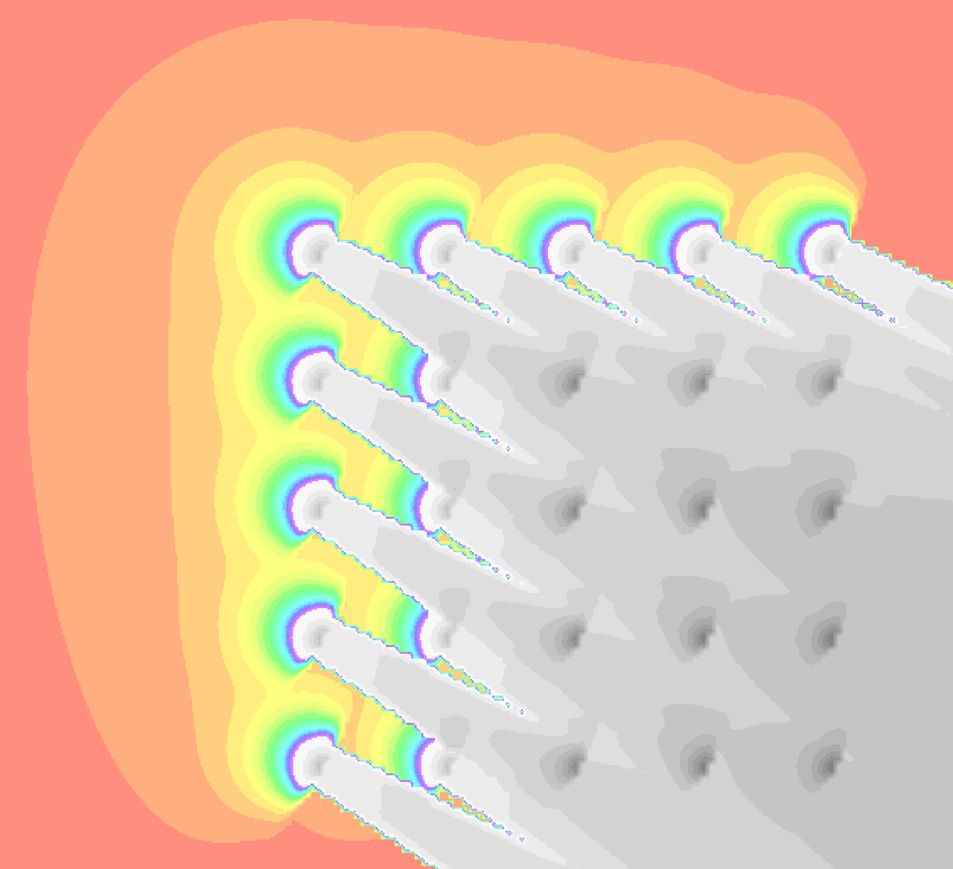
This induction model is based on the work of ARM Forsting and is a simple, fast, engineering model of the slow-down in front of a wind farm. It attempts to model the difference in incident wind between that experienced by a met mast versus a wind turbine. At present this is highly configurable and considered experimental functionality.
IEC61400-12 (editions 1 and 2) obstacle and terrain assessment
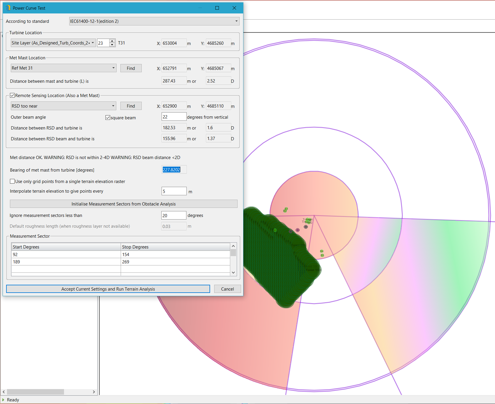
IEC61400-12-1 (editions 1 and 2) – obstacle and terrain analysis tools to allow the easy import, digitisation and enhancement of obstacle and forestry layers.
- Shape files attributes can be automatically read and converted to Openwind obstacle objects
- Rasterisation of forestry polygons into obstacle layers
- Fast plane-fitting
- Measurement sector suggestion
- Automatic generation of obstacle and terrain reports
This functionality facilitates simple, quick and easy, repeatable assessments of measurement sectors for performing power curve tests.
Shadow flicker strategy creation and assessment
Import shadow flicker strategies as time-series of turbine availability. Assess shadow flicker shutdown losses in the light a fixed shadow flicker budgets and likely real case shadow flicker scenarios based on time-series met data. This functionality will use up a shadow flicker budget based on the likely shadow flicker and then calculate the loss once the turbines have to switch to worst case shadow flicker driven shutdown periods.
Substation chaining
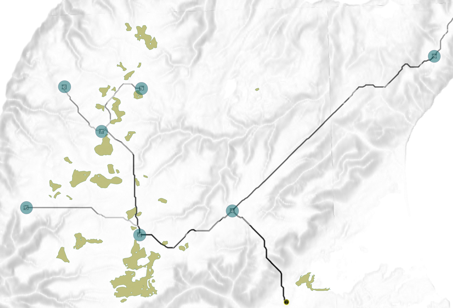
Substation Chaining is designed for large multi-phase projects, this modification to the LCOE optimiser allows users to appropriately share the cost of their HV lines among phases.
Directly import Wind Resource Grid (WRG) files and time series data sets from Windnavigator
In Openwind v 1.9 users can access, order and import Wind Resource Grids files and time series data sets directly from UL’s Windnavigator dashboard. In this video you will learn how to access and utilize this new and convenient feature.
Comprehensive list of Openwind 1.9 features and improvements
- Induction model based on work by Dr. ARM Forsting with tuneable parameters for induction zone combination
- NORD2000 (unvalidated)
- Export reports directly to Excel format
- Improved NRO mode optimisation
- Raster editing
- Dark mode support
- On screen logging
- Permitted location optimisation without buffering points
- IEC61400-12 (Editions 1 and 2) obstacle and terrain assessment
- Define, edit, convert point layers into obstacles
- Rasterise forestry into grids of obstacles
- New wake model (unvalidated)
- Bastankhah (AKA Porte Agel)
- Improved multi-threading
- Improved wake removal
- OpenGL 2D hardware acceleration
- Shadow flicker curtailment strategy creation
- Export to report
- Import from clipboard
- Substation chaining in LCOE optimisation
- Run time-series energy captures with partial (curtailed) values of availability
- Create met mast turbulence tables from background map roughness and wind speed
- Added options to DAWM EV model
- Run time-series energy captures with partial (curtailed) values of availability
- Create met mast turbulence tables from background map roughness and wind speed
- Added options to DAWM EV model
- Export to WindPlanner
- Support for WakeBlaster
- Wierenga can now be used for the estimation of 3 second gust factors
- Wierenga can be used to translate between 10 minute wind speeds and max or min speeds at lower time intervals but only up to 140 seconds
- Input points and turbines as lines or arcs
- Ability to order and download Wind Resource Grid (WRG) files and time series data sets directly from Windnavigator
Sign up for a complimentary trial of Openwind


