UL Solutions’ lidar remote sensing test and calibration site
UL Solutions’ wind test facility is a central United States location built for independent performance verification of lidar and sodar technology. Our mission is to provide a convenient service that enables owners and operators to spend less time shipping and testing units overseas and more time using equipment on sites in the United States.
Remote sensing for offshore wind
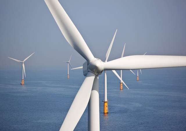
As with onshore wind, surface-based remote sensors are a useful supplement to more traditional offshore tower-based measurement campaigns. When co-located with an offshore met tower, they can extend the wind measurements from the tower height to the top of the turbine rotor plane, providing more accurate wind resource data.
Because these sensors are easier, lighter, and cheaper to deploy than tall towers embedded in the seafloor, they are often used to provide a first indication of the wind resource for an offshore project area. Sensors can be deployed on existing offshore structures, as well as on floating platforms.
As wind turbines become larger and the size and complexity of wind projects increase, there is a growing need for wind resource measurements at greater heights and more locations across a project area.
Surface-based remote sensing, including sodar and lidar, can help meet this need by:
- Measuring the wind profile to the top of the rotor, above the reach of most tall towers
- Observing the spatial distribution of wind resources across a site in a series of brief measurement campaigns
For offshore projects, remote sensing (especially lidar) on floating or fixed platforms may even take the place of tall towers in measurement campaigns.
Traditional approaches to resource assessment that employ multiple meteorological (met) towers can be costly, and usually do not measure the wind above turbine hub height. To reduce uncertainty at an affordable cost, we often advocate a mix of towers and remote sensing instruments.
Lidar vs. sodar wind measurement
Sodar
Sodar (sonic detection and ranging) systems measure wind velocity by emitting acoustic pulses upward and recording the timing and frequency shifts in the backscattered echoes. Typical sodar systems used for wind resource assessment measure the wind from 30m up to about 200m above ground in increments of 5 – 20m.
Lidar
Lidar (light detection and ranging) systems emit pulses or beams and record the timing and frequency shifts of the backscattered signal. Typical lidar systems used for wind resource assessment measure the wind up to about 200m above the sensor. Side-scanning systems with ranges up to a few kilometers are also available.
Both sodar and lidar often supplement traditional tower-based measurements. With the wind profiles, these instruments can provide up to the top of the turbine rotor, it is possible (in UL’s Openwind software, for example) to improve estimates of the energy production of turbines under conditions of extreme high or low shear. Sodar and lidar also provide measurements of vertical wind speed and turbulence, both of which can affect power production.
However, because of continuing concerns regarding the calibration of these instruments against standard anemometers, they are not yet widely used as the sole source of wind resource data.
Get connected with our sales team
Thanks for your interest in our products and services. Let's collect some information so we can connect you with the right person.
Related services
- Renewable Energy Site Screening and Feasibility
- Wind and Solar Resource Measurement Campaigns
- Renewable Energy Resource Assessment
- Wind and Solar Project Design and Energy Assessment
- Renewable Energy Technology Selection and Suitability
- Renewables Environmental and Permitting
- Renewable Energy Project Development Support


